THE project to build a bridge over the River Avon between Keynsham and Hanham has taken a significant step forward.
It would allow pedestrians, cyclists and horses to cross the river border between Bath & North East Somerset to the south and South Gloucestershire to the north.
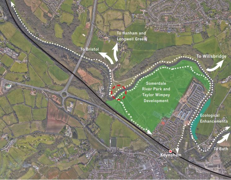
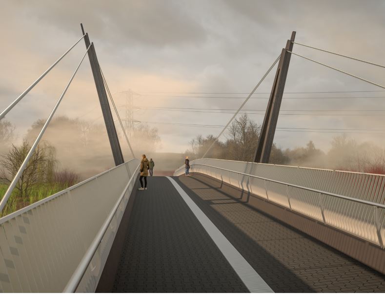
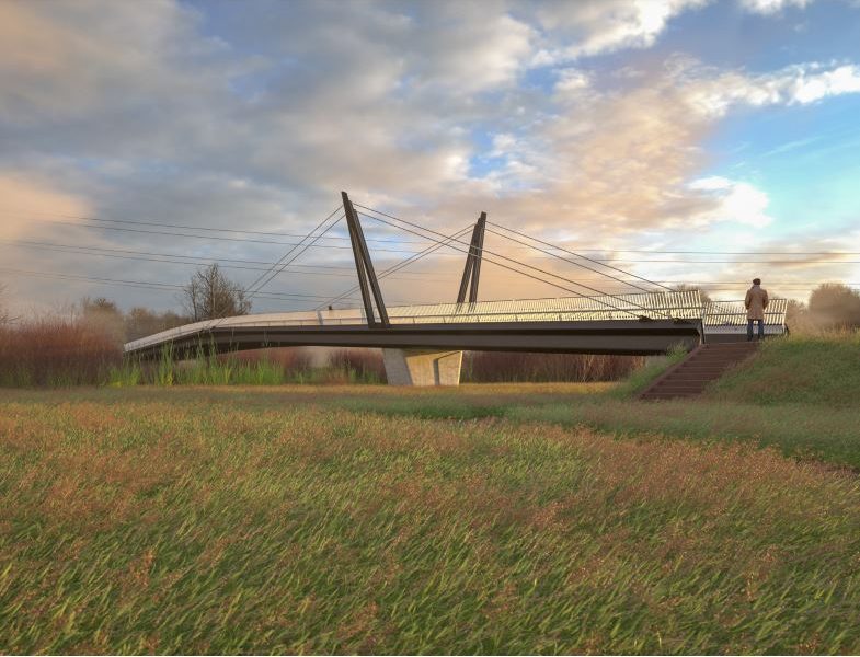
A planning application has now been submitted for the bridge near Durley Lane. It would be 40 metres long and up to 4.3 metres wide, with a rubber-tiled surface suited to horse traffic.
B&NES Council has submitted the application to South Gloucestershire Council, with the two councils sharing jurisdiction over the project.
Contributions to the project’s funding have been made by the West of England Combined Authority as well as Taylor Wimpey, as part of its development of the Somerdale estate.
Buro Happold, the lead consultant, and Moxon Architects secured the commission to design the bridge, whose proposed site lies within the green belt at the river’s midway point between Bath and Bristol.
The planning application says the bridge would open up more possibilities for walking and cycling in the area.
“Routes are limited to one side or the other, useful for travelling along the river but less helpful for onward connections.
“The chosen crossing point is ideal for linking existing routes. It could give users travelling east–west an opportunity to bypass a significant meander of the River Avon. At a regional scale, this point could integrate Keynsham into a larger active travel ring around Bristol, as well as the Bristol and Bath Railway Path.”
The bridge is part of the WaterSpace Connected project, whose aim is “to revitalise the river and riverside” between Bristol and Bath.
The planning application is accompanied by a study that states the project will create a biodiversity net gain of 10.90% for habitats and a 10.29% for hedgerows.
The design takes account of the fact that the bridge will be built on a flood plain and that the Avon is increasingly likely to overflow because of climate change.
“When the river floods (usually in winter and spring) most of the flood plain is submerged for a significant period of time. Because the water is deep and the plain is wide, spanning its entirety is impractical. For this reason, when the river floods the bridge will not be accessible.”
One comment in support of the application comes from a Somerdale resident who states: “I consider this proposal to be of huge gain to both South Gloucestershire and Bath and North East Somerset promoting healthy activities and increasing the accessibility to the countryside.”
Another states: “This will be a fantastic addition to this location. Long awaited and can’t wait for it to be installed. The improved path linking Keynsham to the Bristol/Bath cycle path will prove pivotal in this jigsaw.”
More details of the plans are available on the South Gloucestershire Council planning portal under reference P24/02973/F.
Images: Moxon Architects/Buro Happold